The Crown Point Road; An Introduction
 Across the state of Vermont a chain of markers stretches from the banks of the Connecticut River to the shore of Lake Champlain. Erected at different times, by different people, and made of different materials - granite, marble, stone, wood, metal - the markers have one thing in common; they mark the route of the old Crown Point Military Road.
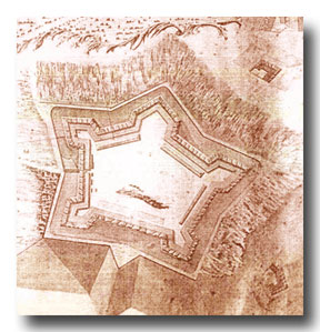
Built in 1759-60, during the French and Indian War, the Crown Point Road was of great importance in the early history of Vermont. It was ordered constructed by General Jeffrey Amherst following his capture of the French forts at Ticonderoga and Crown Point. Its purpose was to connect the great stone fortress at Crown Point, then being built, with Fort No. 4, now Charlestown, New Hampshire. There was a suitable branch nearly straight west to Fort Ticonderoga.
This military road was of prime importance in the plans of General Amherst. The new fort at Crown Point was to be a strong point in the defense [and future development] of the colonies, and a jumping-off point in the campaign against the French in Canada. The new road to No. 4, then the northernmost outpost in the Connecticut River valley, would serve to bring much needed supplies to the fort at Crown Point, as well as troops from New Hampshire, Massachusetts, Rhode Island and Connecticut.
The road, though a poor one by today’s standards, was built well enough to serve its purpose. Portions of the road were graded, trees were cut, stumps removed, bridges and causeways were built, and corduroy sections were laid in swampy areas. Over this road, in the 1760 campaign, passed Colonial troops with supplies, munitions, cattle and sheep for the support of the army at Crown Point.
The Crown Point Road was again used for military purposes during the Revolution when troops and supplies were sent over the road from Fort No. 4 to support the American position at Ticonderoga.
But perhaps the road’s most lasting contribution to Vermont’s history was its use by settlers in the period between the French and Indian War and the Revolution. The road opened a large area of Vermont for settlement and, with the defeat of the French and the lessening danger from Indian raids, settlers were soon traveling the Crown Point Road and building their homes in the valleys and on the hillsides of Vermont.
The Crown Point Road of today has changed greatly. Much of the road has disappeared entirely, reclaimed by the forest. Other parts have been plowed under or bulldozed away to meet the needs of the expanding population of the nineteenth and twentieth centuries. Some sections of the road are marked and can be followed as trails, while other sections are barely discernible paths through the woods, marked only by the lilac-fringed cellar holes and stone walls of abandoned farms. A few short stretches of the old military road are still in use as town roads.
Written by: Martin J. Howe, First President of the CPRA